
What to see
The water stays shallow for up to 150 metres over fine sand, and the bay is shielded from the east wind, which makes it unusually calm for this coast. The white Kerpe rocks on the headland are the place for sunset.
A beach day, or a weekend with Kefken next door.
July to September brings crowds of day-trippers; weekdays are calmer.
Getting there
About 10 km from Kandıra and 50 km from İzmit by road (municipality figures).
Transport lines are general directions, not checked against the operator's timetable.
Open in OpenStreetMap See it on the Kerpe, Kefken & Akçakoca map
Nearby
-
 Kefken and the Pink Rocks4.5 km in a straight line · ~12 min by road (estimate)
-
 Kilimli Bay28 km in a straight line · ~49 min by road (estimate)
-
 Ağva29 km in a straight line · ~50 min by road (estimate)
-
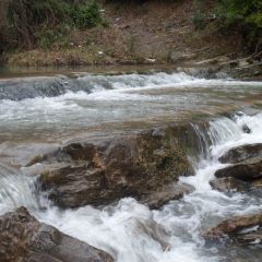 Hacıllı Waterfall37 km in a straight line · ~1.1 h by road (estimate)
-
 Şile Lighthouse49 km in a straight line · ~1.4 h by road (estimate)
Where to stay nearby
ilçemde shows no Ministry-licensed count for Kandıra (incl. Kerpe and Kefken); its page still lists hotels and guesthouses in the district.
Hotels and guesthouses in Kandıra ↗
Accommodation lists open on ilçemde, our sister directory of Turkish businesses (new tab). We do not take bookings or commissions.
Pharmacies on duty tonight in Kandıra ↗ The list changes every day; on-duty pharmacies stay open when the others are closed.
About this page
Location: Mavi Bayrak 2026 (FEE) — Kerpe Halk Plajı, konum kıyı kontrolüyle doğrulandı (veri/site/mavi-bayrak.json) — resmî sayfanın kendi harita bağlantısı (13.10.2026). Ticket, hours and closing days: only from the operator's own pages; anything we could not confirm there is marked “Not verified”. Last checked 13 Oct 2026.